I had originally intended to generate maps from the data in the individual Roll of Honour records, but it seemed a little superfluous when the A Street Near You web site was launched in 2018. However, I’ve revisited the idea for the following reasons. Firstly, the records on Huddersfield Exposed have more detailed content, such as places of work, worship, and recreation. Secondly, much has changed in a century — roads have been renamed or renumbered, vast swathes of residential housing was lost to “slum” clearances, road widening, and the building of the Huddersfield ring road — and this has an impact on A Street Near You’s ability to accurately identify locations.
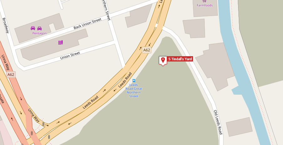
For example, Ordinary Seaman Sheard Windle (1891-1917) lived at 5 Tindall’s Yard, Hawk Street, Huddersfield. A Street Near You places this location as being near the bus station, but Tindall’s Yard was to be found on the eastern side of the town.
By checking the 1960 O.S. map, I was able to pinpoint exactly where number 5 once stood:
 .
.